

Beinn Tairbeirt [Ben Tarbert]
Good walks are even better shared.
Overview
Overview
Beinn Tairbeirt, or Ben Tarbert to the uninitiated, stands proudly in the rugged Scottish Highlands, offering magnificent views and a rewarding climb for those who dare to tackle its slopes. At an elevation of 570 meters, it's classified as a Marilyn, meaning it's a mountain of some significant prominence.
Geology
The geological makeup of Beinn Tairbeirt includes schist and granite, forming a landscape that is as enchanting as it is complex. The sharp contours and rocky outcrops are a testament to the powerful forces of nature that have shaped this area over millennia.
Routes
The most popular trail is the East Ridge Route, a moderate ascent that starts in the village of Tarbert. Expect to navigate through swathes of heather as well as occasional rocky sections. Be sure to pack your sense of humour, as you might encounter a stubborn sheep or two!
Summit Features
Upon reaching the summit, you'll be greeted by a humble cairn marking your victorious ascent. It's the perfect backdrop for a selfie, as you soak in the breathtaking scenery.
Terrain Type
The terrain can vary – think rocky paths paired with lush grassy stretches. It's advisable to wear sturdy footwear that can handle both the squishy and solid ground.
Views
From the summit, you'll enjoy sweeping vistas that will make your heart sing and your legs forget the climb. Loch Fyne glistens below, framed by majestic mountain backdrops. For the best experiences, aim for spring or summer when views are crystal clear; but don’t discount autumn for its spectacular colour display.
Hazards
While the paths are generally safe, keep an eye out for loose rocks and be mindful of potential changes in weather, which can be as unpredictable as a cat on a hot tin roof. If a sheep decides to stand in your way, be prepared to negotiate!
Access
Getting to Beinn Tairbeirt is a breeze, especially with parking available in Tarbert. That said, during busy seasons, you might need to employ a bit of patience. There are also public transport routes available, with buses connecting Tarbert to larger hubs like Glasgow.
Facilities
Before or after your hike, you can indulge yourself in the charming cafes and pubs in Tarbert, where the locals are friendly, and the cakes are delicious.
History
The very name 'Tairbeirt' reflects its geographical significance, serving as an 'isthmus' between two lochs. Historically, the region is rich with tales of fishing and clan battles, giving hikers not just a journey through nature but also a stroll through history.
Set your sights on Beinn Tairbeirt – it promises an adventure that's brimming with stunning views, rich history, and a touch of humour along the way. Happy hiking!
Explore routes near Beinn Tairbeirt [Ben Tarbert]
Public walks starting within 80 km of this hill. Nearby does not mean a route reaches the summit; check its map and access before setting out.
Dun Mhulan Broch Quick Walk
View route
Berneray Community Hall to the beautiful beach
View route
Beautiful private beach walk Isle of Harris
View route
Route planning notes
These notes describe possible approaches, not verified navigable routes or permission to cross land. Check current paths, local access rules and conditions before setting out.
East Ridge Route
A scenic ascent starting from the village of Tarbert, weaving through heather and rocky outcrops, culminating in panoramic views from the summit.
Make a day of it, together
Find someone to share the walk with, or organise a day out along a route you like.
Photo Gallery
View all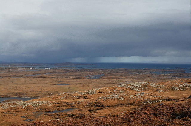 Photo could not load
NF8039 : View North East from Beinn Tairbeirt
Rupert Fleetingly
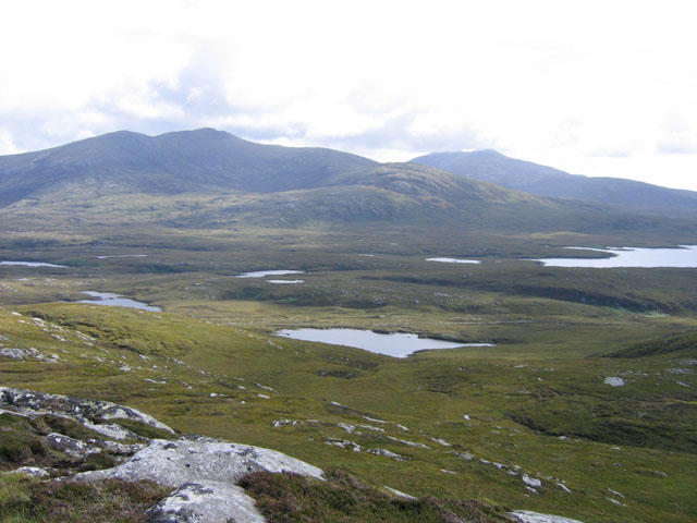 Photo could not load
NF8039 : Summit of Beinn Tairbeirt
Peter Wyatt
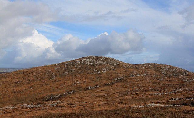 Photo could not load
NF8039 : Beinn Tairbeirt
Rupert Fleetingly
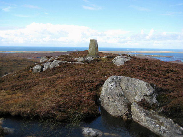 Photo could not load
NF8039 : Summit of Beinn Tairbeirt
Rupert Fleetingly
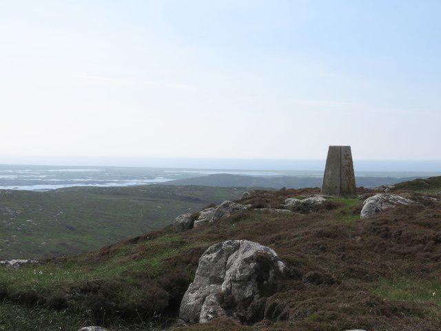 Photo could not load
NF8039 : Summit of Beinn Tairbeirt, South Uist
Becky Williamson
Hill facts and local notes
Classifications
Elevation
168m
553 ft
Prominence
145m
Coordinates
57.3343, -7.3078
NF807395
OS Map
22
Explorer: 453N
At the Summit
The summit is marked by a modest cairn and offers expansive views over the surrounding lochs and peaks, perfect for a celebratory snack atop the world.
Terrain & Geology
The mountain is primarily composed of schist and granite, providing a rugged landscape that contributes to its striking beauty and diverse habitats. You'll notice the distinctive glacial features typical of the region.
Views & Scenery
Stunning vistas of Loch Fyne and the jagged peaks of the surrounding area, particularly Beinn Sgallach and the higher mountains to the north.
History & Heritage
Name Origin
The name 'Tairbeirt' comes from the Gaelic word 'Tairbeart', meaning 'isthmus', referring to its geographical position between two lochs.
Historical Significance
This area has a rich history of fishing and is linked to various clan battles. The lochside villages echo tales past; perhaps you’ll hear a ghostly tale or two at the local pub.
Getting There & Facilities
Check current local access restrictions, parking rules and transport timetables before travelling. These notes do not confirm public access to the summit.
Parking
Parking is available at the village of Tarbert, just a short walk from the trailhead. Note that spaces may fill up quickly during peak tourist season.
Public Transport
Regular bus services connect Tarbert with nearby towns, with the closest train station located in the bustling city of Glasgow, approximately 1.5 hours away.
Nearby Facilities
Tarbert has a selection of cafes, pubs, and public toilets, making it a quaint spot for a pre-hike coffee or a post-hike pint.
Safety Information
Known Hazards
- Loose rocks on the ascent and descent, sudden weather changes, and the occasional confused sheep that may block your path.
General Safety Tips
- Check weather conditions before setting out
- Carry appropriate clothing and equipment
- Let someone know your planned route
- Take a map, compass, and GPS device
- Carry emergency supplies: food, water, first aid kit, torch
Hills
Some common questions about the hills answered
Are there group walks up Beinn Tairbeirt [Ben Tarbert]?
Many walkers use Walkmates to join or organise walks with others. You can check for group walks around Beinn Tairbeirt [Ben Tarbert] through the maps
Are there other walkers around Beinn Tairbeirt [Ben Tarbert]?
Activity varies by location and time, but Walkmates lets you see whether others have shared walks or shown interest in this area. Find other people through the walking friends search walking friends for Beinn Tairbeirt [Ben Tarbert] search or of course create your own walk for Beinn Tairbeirt [Ben Tarbert]
Can I organise a walk to Beinn Tairbeirt [Ben Tarbert]?
Yes. If there aren’t any walks listed already, you can create a walk and make it available for others to join.
If you're signed up to Walkmates, you can create a walk to Beinn Tairbeirt [Ben Tarbert].
How do I find a walk up this hill?
There are often multiple ways to walk this hill, depending on experience and route preference. Walkmates helps you explore walks and routes that others have shared.
Can I suggest a new route up Beinn Tairbeirt [Ben Tarbert]?
Yes. You can suggest or create routes to share with others. Walkmates focuses on the social side of walking, so routes are used to help people organise walks and explore areas together, rather than as detailed navigation tools or route libraries.
Other uses really appreciate knowledgeable walkers sharing their routes. Share your favourite route to Beinn Tairbeirt [Ben Tarbert] here
The is an error or something incorrect about this hill. How do I let you know?
We always strive to keep the information on Walkmates as accurate as possible. If you find an error, please let us know through the contact form and we'll aim to correct it as quickly as possible
Community Discussion
Comments
Location
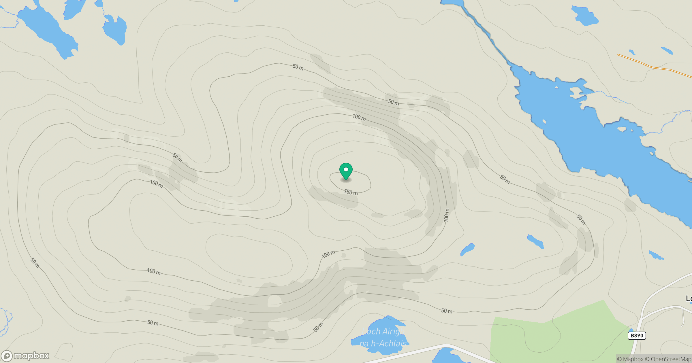
Grid reference: NF807395
View on OpenStreetMapOpens a map in a new tab, centred on the hill.
Hills within 30 km
Straight-line distance, not a walking route or confirmation of access.
Eabhal [Eaval]
347m
Hecla [Thacla]
607m
Beinn Choradail [Ben Corodale]
526m
Beinn Mhor
620m
Beinn Ghot
177m
No comments yet. Be the first.